

Most environmental satellite-based remote-sensing data archives are open and freely available to the public. They are provided by the National Aeronautics and Space Administration (NASA), the National Oceanic and Atmospheric Administration (NOAA) in the U.S. Department of Commerce, the Unites States Geologic Survey (USGS) in the U.S. Department of the Interior, and various university and research organizations. Each may have its own online data access tool. This section will introduce several and illustrate how to use them. Each of the panels below describes one of these tools, provides a link to the web-based application, offers a how-to-use-it tutorial video, and links to a lesson plan in the SEA Lesson Plan Library that illustrates student use of each. A PDF viewer such as Adobe Reader or equivalent is needed to view the lesson plans outside of your up-to-date browser.
IMPORTANT NOTE: NASA Worldview and NOAAView are high-level data retrieval and visualization tools. That is, the data display have already been processed beyond Level 4 to enhance usability and application. Like the GOES Image Viewer, neither requires login. GIOVANNI (a NASA EarthDATA tool) and GloVis (from USGS) offer slightly lower-level and subsets. The USGS GloVis requires a login to download data. NASA EarthDATA's GIOVANNI requires a login for only one of four download formats. The Login link for each can be found on the right side of the menu bar; use it either to login or to create an account with the data provider. Accounts are free and take only a minute of time to create online. NASA EarthDATA login credentials open access to GIOVANNI and all other NASA EarthDATA sites. A USGS account provides access to all USGS Earth Resources Observation and Science center (EROS) data.
PLEASE REMEMBER: When you download and use image data from any web site, be sure to include appropriate citation and credit for the data source and preparation. Some sites include citation guidelines. If needed for reference, the Federation of Earth Science Information Partners (ESIP), a Satellite Educators Association Partner in Education, published easy-to-use guidelines for properly citing downloaded image data.
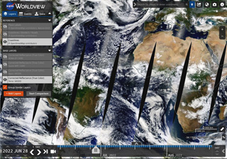
"NASA's Worldview lets you explore Earth as it looks right now or as it looked almost 20 years ago. See a view you like? Take a snapshot and share your map with a friend or colleague. Want to track the spread of a wildfire? You can even create an animated GIF to see change over time.
"Through an easy-to-use map interface, you can watch tropical storms developing over the Pacific Ocean; track the movement of icebergs after they calve from glaciers and ice shelves; and see wildfires spread and grow as they burn vegetation in their path. Pan and zoom to your region of the world to see not only what it looks like today, but to investigate changes over time. Worldview's nighttime lights layers provide a truly unique perspective of our planet.
"What else can you do with Worldview? Add imagery by discipline, natural hazard or key word to learn more about what’s happening on this dynamic planet. View Earth’s frozen regions with the Arctic and Antarctic views. Take a look at current natural events like tropical storms, volcanic eruptions, wildfires and icebergs at the touch of a button using the 'Events' tab.
"Explore your Earth your way with Worldview today!"
(Jennifer Brennan - https://www.nasa.gov/feature/goddard/2018/explore-earth-your-way-with-worldview)
Access Worldview here: https://worldview.earthdata.nasa.gov/.
Worldview is primarily a data visualization tool although some analysis capabilities are included. Menu options allow users to capture a selected region and save as PNG (portable network graphics), JPEG (Joint Photographic Experts Group), or GeoTIFF (Georeferenced Tag Image File Format) which is useful for analysis with MultiSpec or ImageJ.
Go to Worldview opens the Worldview home page in your browser. Video Tutorial takes you to an updated, seventeen minute video from NASA about how to use Worldview. It walks you through the Worldview's own tour before illustrating use of each built-in tool. Online Guide is a link to the My NASA Data Guide to Using NASA Worldview in the Classroom housed at NASA's Langley Research Center.
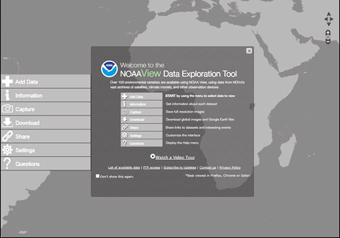
NOAAView is an online exploration tool for satellite-based remote sensing data. Over a hundred environmental variables are available for ocean, atmosphere, land, and cryosphere parameters as well as climate and weather models. NOAAView is primarily a visualization tool. Data views can be scaled from global to local, animated over time, and downloaded for later use. Information about each visualization is available at the click of a button. Menu options allow users to capture a selected portion of a visualization and save as PNG (standard image file format) or KMZ (for use with Google Earth). Tutorial videos are available in NOAAView or they can be viewed via YouTube.
Access NOAAView: https://www.nnvl.noaa.gov/view/globaldata.html.
Go to NOAAView opens the NOAAView initial screen. No login or registration is required for using NOAAView. Users will not find a Help button in NOAAView. Instead, Questions on the side menu opens a welcome/help screen that includes a video tour link. The same video can be viewed with the Video Tutorial button below. Other links on the startup screen access a list of available datasets and FTP access to all data. Additional help is found in each menu option. The Lesson Plan is from the Analysis Toolbox in the SEA Lesson Plan Library. It meets NGSS standards for grades 6-12 and can be adapted for use in any subject area. Using NOAAView downloads a PDF summary to help get you started.
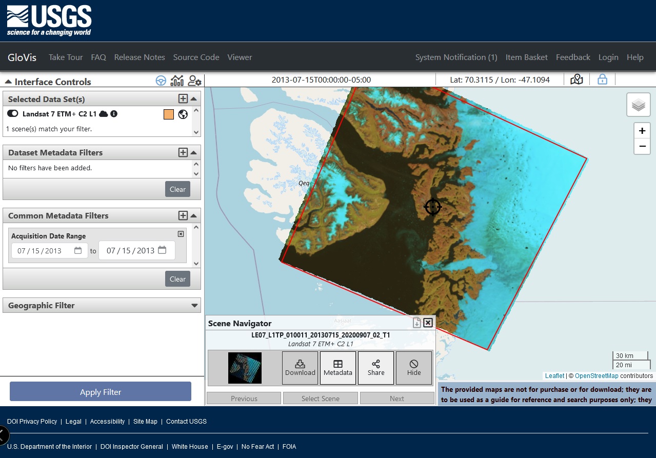
The United States Geologic Survey (USGS) maintains archives of all Landsat data, the aerial surveys of the United States, and real-time data for streamflow, flood, drought, earthquake, volcano, landslide, geomagnetism, and more. Data are available in various formats including geographic information system (GIS) shapefiles. Online data access tools from USGS include Earth Explorer, GloVis, LandsatLook, and more. This section will introduce the Global Visulaization Viewer (GloVis). Since GloVis accesses only publicly available data, all downloaded datasets are in the public domain, which means there are no copyright or licensing restrictions.
Access GloVis here: https://glovis.usgs.gov/.
Go to GloVis opens the GloVis home page. The Help link on the GloVis home page opens the GloVis Help Index. This Index page contains a link to GloVis Tour which starts the bulit-in GloVis tour. Additionally, the Video Tutorial button below links to a short video created by the Satellite Educators Association to illustrate the use of GloVis. The video shows how to find and download a specific Landsat scene dataset with GloVis. Please view this video page with a competent, up-to-date browser such as Firefox, Opera, Safari, Edge, or Chrome. Internet Explorer is no longer recommended. Remember, in order to download datsets, users must login with EROS Registration System credentials. The Lesson Plan is from the Analysis Toolbox in the SEA Lesson Plan Library. It meets NGSS standards for grades 6-12 and can be adapted for use in any subject area. Using GloVis downloads a PDF summary to help get you started.
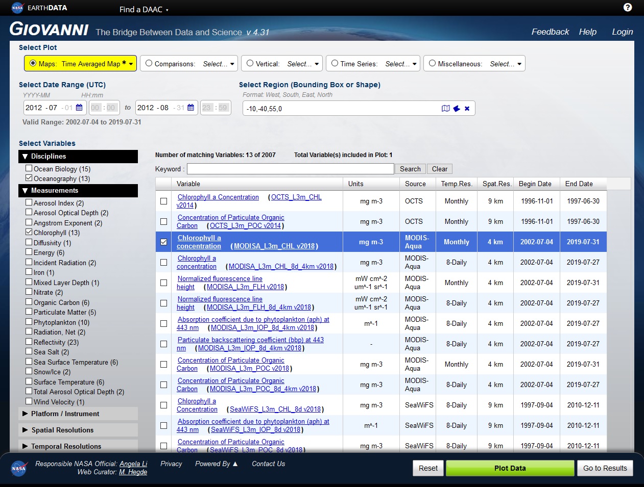
NASA EARTHDATA is NASA's Earth Observation System Data and Information Service. It includes access to most NASA archives of satellite-based remote sensing data and some outside of NASA. It links to a dozen different NASA distributed active archive centers, or DAACs, from which specific data can be retrieved. Data are available from measurements of the atmosphere, land, ocean, cryosphere, radiance, and human dimensions. EARTHDATA has its own user interface, but it also link to a long list of tools for data retrieval, visualization, and analysis. GIOVANNI Intereactive Visualization and Analysis is one of those data retrieval tools. You can dig around in the EARTHDATA site to find the GIOVANNI link or just use this one: https://giovanni.gsfc.nasa.gov/giovanni/.
The video button below links to the GIOVANNI YouTube Channel. It is NOT necessary to Sign-in to view and hear the 4-1/2 minute video. Additionally, the Help link in the upper right corner of GIOVANNI's screen opens an extensive User Guide. The lesson plan is from the Analysis Toolbox in the SEA Lesson Plan Library. It meets NGSS standards for grades 6-12 and can be adapted for use in any subject area.
Go to GIOVANNI opens NASA's GIOVANNI. The Video Tutorial button below links to a YouTube video produced by NASA's Health and Air Quality Applied Sciences Team (HAQAST). Additionally, the Help link in the upper right corner of GIOVANNI's screen opens an extensive User Guide. The Lesson Plan is from the Analysis Toolbox in the SEA Lesson Plan Library. It meets NGSS standards for grades 6-12 and can be adapted for use in any subject area. Using GIOVANNI downloads a PDF summary to help you get started.
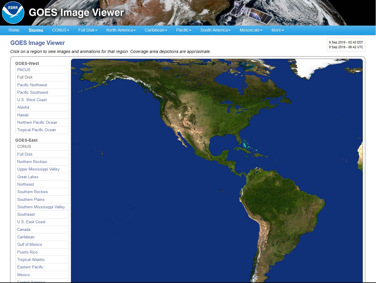
GOES Image Viewer is a web app from NOAA STAR. The Center for Satellite Applications and Research (STAR) is the science arm of the National Environmental Satelite, Data, and Information Service (NESDIS), which acquires and manages the nation's environmental satellites for the NOAA. Weather satellites include polar-orbiting (JPSS) and geostationary (GOES) satellites. The new GOES-R series of weather satellites include GOES-16 (GOES-East) and GOES-17 (GOES-West) providing full-disk hemispheric and regional views from the mid-Pacific to the mid-Atlantic Oceans. New image data is posted every 5 minutes for each of 16 dicrete wave bands and 2 composites, GeoColor and AirMass. Most current images can be viewed or downloaded in 5 JPEG image sizes or animated GIF or the last 1-8 hours. Several bands also offer GeoTIFF imagery in KMZ.
Access GOES Imager Viewer: https://www.star.nesdis.noaa.gov/GOES/index.php
GOES Viewer opens the GOES Image Viewer homge page. No login is required to use the GOES Image Viewer. Additional helpful information is located throughout the viewer site. The Video Tutorial was created by the Satellite Educators Association to illustrate the use of GOES Image Viewer. Please view this video page with an up-to-date browser such as Firefox, Opera, Safari, Edge, or Chrome. Internet Explorer is not recommended. Using GOES Image Viewer downloads a PDF summary to help et you started.
There are many excellent and accessible archives available via Internet connection, certainly too many to list here. The following are satellite image sources that have been referenced in one or more lessons in the SEA Lesson Plan Library. Comparing this with the More Visualization Tools and More Interpretation Tools, there is a great deal of cross over between lists. Lack of inclusion on this list does not in any way reflect on the value of a site for specific purposes. You are invited to explore.
You are invited to explore these areas in sequence or skip to the topic of greatest interest: